
WAIPT Project
World Atlas of Indigenous Peoples' Territories (WAIPT) Project
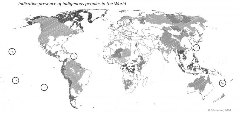
The World Atlas of Indigenous Peoples' Territories (WAIPT) project is conducted since 2013 by a joint collaboration between the leading French research centre CNRS, the French division of the NGO Survival International, and the Sorbonne Nouvelle University, Paris III, with the support of the Ile-de-France region.
This project aims at building a world geographic database of indigenous lands and territories, maintained by a collaborative international network of information exchange. Voluntary contributions from numerous organizations working on indigenous land issues will allow to progressively reach a global coverage of Indigenous People's presence and comprehensively locate of their territories.
This unique centralized platform would be a powerful tool in scaling up initiatives for securing indigenous land and resources rights to a global level. It will improve knowledge of indigenous status for increased awareness, understanding, and action. Thus, indigenous peoples and organizations will have higher visibility both at local and global levels which is often missing in certain regions of the world.
Since 2014, WAIPT is a member of the Operational Team of LandMark, the first online interactive platform to provide maps and other critical information on indigenous and community lands at a global scale.
LandMark was launched in November 2015 by a coalition of 13 organizations and experts from around the world. It can be consulted at www.landmarkmap.org.
Contacts WAIPT :
Fabrice Dubertret, PhD student, principal operator - fabrice.dubertret@etud.sorbonne-nouvelle.fr
François-Michel Le Tourneau, PhD, Research Director at CNRS - fmlt@fmlt.net
Jean-Patrick Razon, PhD, ex Executive Director at Survival France - jp@survivalfrance.org
|
|
|
|
|
|
||